Assessment of Ecosystem Services is the way to show importance of ecosystem in human life to the society. From the perspective of regional planners, it is a supporting instrument for planning the use of an area. However, it is a really difficult scientific task to implement this assessment, since a lot of sidderenc factors and data should be analyzed and compared.
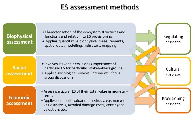
Ecosystem service (ES) assessment can be performed by using different assessment methods – biophysical, social or economic. These methods are complementary to each other, but each can provide different set of answers, essential for decision makers. Economic and social assessment reveals the direct benefits to society and thus can support decision making on certain land use projects that have impact on different groups of the society. While biophysical assessment helps to understand the functioning of ecosystem and importance of different species, habitats and types of land cover in supply of the ecosystem services. It provides basis for ES mapping and can be reflected in spatial planning, nature conservation and decision making on spatial solutions for land management and use of nature resources.
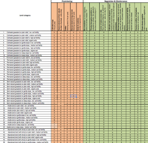
Biophysical assessment methods are used to quantify ecosystems’ capacity to deliver ecosystem services for human benefit and the amount of harvested yield provided by such capacity. For that purpose, the data from direct measurements of the biophysical parameters (e.g. field surveys, monitoring, statistics) can be applied. However, obtaining, processing and analysis of field data might be considered as very expensive and time-consuming process. Therefore, in data-scarce areas biophysical ES mapping is often based on more simple approaches using expert knowledge and relating indicators for assessment of ecosystem services to land cover types or abiotic and biotic variables. Such assessment usually is performed in a relative scale using so called “spreadsheet” or “matrix” method. Experts provide a score of ecosystem services supply for each type of land cover/ ecosystem/ habitat. These scores can be used to directly map ES, based on the land cover map.
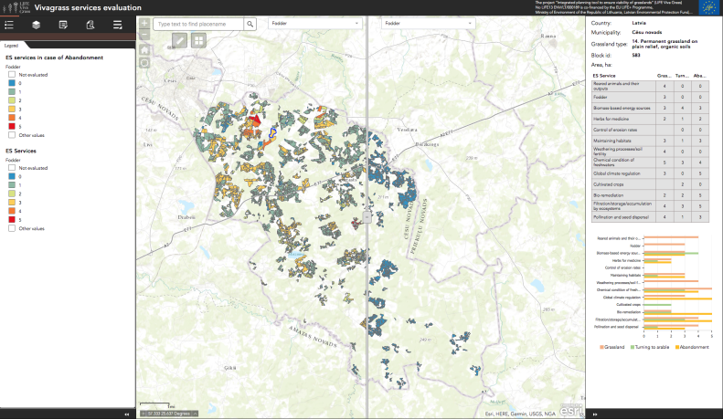
In the LIFE VIVA GRASS project the biophysical mapping of ecosystem services within eight case study areas is performed using the spreadsheet method, which is complemented with data from field surreys and airborne images (LiDAR data). The purpose of ES mapping in the project is to provide information on the current status of grassland ecosystem services, to be used within the Integrated Planning Tool for assessment of different grassland management scenarios and their outputs in relation to ES trade-offs and related benefits for farmers and society. The data sets on current grassland management practice in combination with the soil maps and topography were selected to define the mapping and assessment units, while expert knowledge is used for qualitative assessment of the selected ES for each grasslands category defined by the management practice, soil fertility and relief features.
Results of the ES is presented in the document below.
Those results were also included into the tool.


It is nice to read that data ecosystem services are used to the benefit of farmers and society. This makes it a great tool to make sure that things are being run in a responsible manner. A good friend interested in this service would like knowing this.